
Purposes of Use
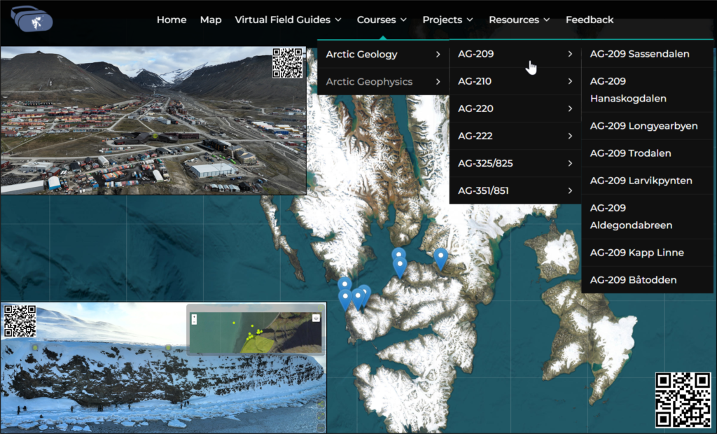
VRSvalbard has been implemented as a teaching tool in several courses at UNIS. In sequence, it has been taken up in: AGF-213, AGF-350/850, AG-209, AG-210, AG-220, AG-222, AG-351/851, and AG-336/836. It has been used for various purposes in the courses including: as a resource for course assessments and activities, as preparation for site visits, as a demonstration tool in lectures and in-class activities, etc. The use of VRSvalbard in UNIS courses has provided invaluable feedback on the experiences of instructors and students; this feedback is being actively and continuously collected through short informal interviews (with instructional staff) and in-class discussion and surveys (with students). We discuss each case specifically to highlight unique use of and feedback related to VRSvalbard in specific courses.
Arctic Geophysics Courses
AGF-213 Polar Meteorology and Climate
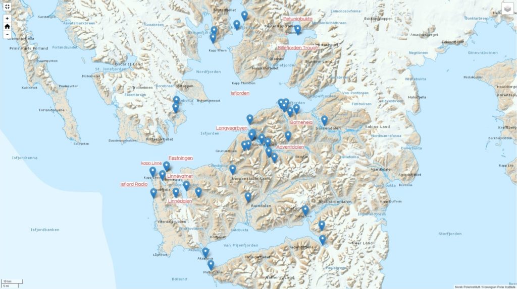
AGF-213 is a BSc-level course that runs annually from August to November. It offers an introduction to and overview of weather and climate processes that are typical for polar regions, with examples focusing on local conditions in the European Arctic and around Svalbard. A center piece in the course learning activities is fieldwork lasting about a week. During this fieldwork, which is typically arranged at Kapp Linné and at Petuniabukta in early autumn (Figure 1), the students are trained in field-based research methodology, targeting meteorological phenomena that are typical for the Arctic. This includes training in the process of collecting data using a range of different meteorological instruments such as weather stations in addition to data analysis using different types of software. Both Kapp Linné and Petuniabukta are relatively remote sites, and the students are therefore not able to visit the sites before or after the fieldwork. This limited access to the fieldwork sites might make both planning of the fieldwork and the interpretation of the resulting data challenging, as both typically rely on a good appreciation of the natural surroundings of the field site. The immersive photospheres on VRSvalbard aid the students in overcoming both these challenges. They give a much more realistic appreciation of the field sites than, for example, traditional 2D maps. Thereby, the students are better able to plan the optimal placement of instrumentation for targeting specific meteorological phenomena, which are typically strongly influenced by land-surface contrasts and topographical features that stand out much more clearly in the VRSvalbard material than in traditional 2D maps. Also, VRSvalbard lets the students virtually visit the field sites after the fieldwork and they are thereby able to better interpret their observations in the context of the physical environment of the field sites .
AGF-350 / AGF-850 The Arctic Atmospheric Boundary Layer and Local Climate Processes
AGF-350/850 is a combined MSc/PhD-level course that runs from January to February. The course covers themes relevant for the Arctic atmospheric boundary layer including theory of the boundary layer with special emphasis on the stable boundary layer. Like in AGF-213, fieldwork is a central element amongst the learning activities and VRSvalbard is useful for much the same reasons as in that course. However, unlike in AGF-213, this fieldwork takes place during the polar night when there is no daylight. Therefore, even though the fieldwork is just outside Longyearbyen, where the students live, it is hard for them to get a proper, first-hand of the surrounding landscape. This highlights a key-feature of VRSvalbard, namely the guaranteed (virtual) access to field sites in daylight and good visibility.
Arctic Geology Courses
AG-209 The Tectonic and Sedimentary History of Svalbard
The BSc-level course AG 209 runs from mid-January to early June annually and is one of the oldest courses offered at UNIS. The course addresses the fundamental principles of geology, covering topics such as rift basins, faults and thrust belts, foreland basins, and carbonate platforms. The unique geological outcrops of Svalbard serve as illustrative case studies.
One of the challenges faced by students is the integration of local outcrop-scale observations with published regional-scale geological maps and cross-sections. The course field work is conducted in spring season, where extensive snow cover allows to move along and across a range of the geological structures. However, it also presents challenges in observing large (mountain)-scale geometries. Since the course addresses hundreds of meters to tens of kilometres-scale elements, it relies on analyses of the landscape, including the arrangement of exposed beds, their surface expression, orientation, and geometries. This approach requires a good overview of the snow-free landscape which is crucial for student learning.
VRSvalbard was introduced as a tool in the course in 2022 as a fieldwork preparation tool, allowing students to get familiar with the planned field locations prior to the fieldwork and gain mountain to regional-scale overview of the landscape. The advantage of VRSvalbard is the possibility to change perspective allowing students to see geological features from a bird’s-eye view. Navigating around these structures allows for observations from different angles facilitating a three-dimensional overview of exposed geometries. This was important during the five-days long excursion from Longyearbyen to Isfjord Radio during which students would transect along fold and thrust belt and associated foreland basin (Figure 2). The students often print the images from VRSvalbard to compare with snow-covered succession. VRSvalbard was also used after the excursions, allowing to wrap up the activities and put local observation into the larger context. Additionally, VRSvalbard is actively used post-fieldwork, allowing synthesizing the field activities and place local observations within a larger geological context.
AG-210 Quaternary and Glacial Geology of Svalbard
The BSc-level course AG-210 is a field-intensive exploration of the geomorphology, sedimentology, and stratigraphy of glaciated, formerly glaciated, and glacially influenced Arctic landscapes. Delivered annually, the course spans the autumn semester from early August through to late November. A six-day field school undertaken in a series of glacial forefields in Isfjorden, Svalbard, accessed daily by high-speed open boat, as well as several more local excursions to a range of glacial geomorphic settings forms the centerpiece of the course. During this time, students develop important field skills and generate new data essential for their term projects. This field time is supplemented by independent student-lead fieldwork conducted in the immediate environment around Longyearbyen, accessed by road or on foot, where students further hone their Arctic field skill set and address their own research questions. Snow-free conditions and sufficient day length are essential to the AG-210 field component such that the majority of fieldwork must be conducted early in the syllabus during August and September. This results in a “front-heavy” programme with little classroom time to develop comprehension and understanding of landscape systems and processes before students are undertaking research in the landscape. In such a situation, VRSvalbard has proven particularly valuable to enhance student learning and develop landscape understanding far faster than conventional textbook, satellite, and air photo approaches.
Starting in 2022 and more intensively in 2023, VRSvalbard has been used widely in AG-210 across a range of pedagogic and research settings. From a classroom perspective, the platform has been used by lecturers to illustrate a variety of landforms in real-world Svalbard settings to facilitate basic geomorphic competence. Similarly, students have used VRSvalbard for a range of active learning applications including short groupwork activities identifying and describing landform assemblages. Further, VRSvalbard has been used extensively by lecturers and students during fieldwork scientific planning and post-field interpretation where the photospheres have proved particularly useful in identifying locations for on-the-ground research and aiding in subsequent analysis and mapping. The platform has also been used regularly by students, lecturers, and field engineers for field logistics and safety planning to determine terrain risks, access routes, and safe boat landing areas. VRSvalbard has also proven to be an essential tool in multiple novel student term projects, enabling detailed geomorphic and surface sediment mapping in areas where students have limited field time or where conditions prevent direct access. An example of the latter would be a 2023 term project where the student developed a detailed geomorphic map of a complex rock glacier system in the small cirque basin on Litle Bjørndalen, Svalbard, based entirely on VRSvalbard imagery where steep slopes inhibited access. VRSvalbard UAV missions were flown specifically to support this project.
Within the teaching and learning framework of the AG-210 course, VRSvalbard has been invaluable, dramatically expanding the ability of students to visualize and understand landform processes and assemblages. The platform provides both lecturers and students with a hitherto unattainable perspective that fundamentally enhances spatial understanding of landscape systems and has proved vital in both teaching and research contexts.
AG-220 Environmental Change in the high Arctic Landscape of Svalbard
AG220 is a BSc-level course, offered in the summer season for geology and physical geography students. This field-oriented course investigates climatic and watershed processes that influence the modern glacial, fluvial, lacustrine, marine and periglacial systems in the high Arctic setting. The main fieldwork in the course has been undertaken at two principal field sites: (1) Linnédalen, west Spitsbergen, where we have archived detailed measurements and observations of climatic and watershed processes since 2004 including glacier mass balance, snow depth, stream and lake temperatures, ice-in and ice-out dates on the lake and other environmental parameters, and (2) Longyeardalen, a glacier-river-fjord system. The records of environmental change from these valleys provide a baseline against which future changes in the region will be measured. The students are required to complete an independent research project for the course on some relevant aspect of the field studies. They initially utilize VRSvalbard imagery for orientation in the field area and for planning day-to-day activities and excursions. Once an independent project is identified, the imagery can be used to detect changes in the landscape (glacier margin retreat, river channel migration, or slope processes), by comparison with archived air and satellite images.
AG-222 Integrated Geological Methods: From Outcrop to Geomodel
The full-semester BSc-level course AG-222 runs annually from mid-January to early June and exposes up to 20 students to a range of digital geological techniques. The course motivation, course modules, field work campaigns and the usage of digital outcrop models from Svalbox are covered by Senger et al. (2021). Here we focus on the usage of VRSvalbard in the course.
The students use VRSvalbard to prepare for most field activities. Snowmobile-based field campaigns to Botneheia (day trip) and the Billefjorden Trough (overnight trip) often expose only a fraction of the rock exposures due to significant snow cover. Photospheres are systematically acquired at field locations to document the conditions during the actual campaign. But students are also provided with photospheres and digital outcrop models from the same sites during the snowfree summer, facilitating geological interpretations.
During the first two months of the course the sun does not rise in Longyearbyen and fieldwork is therefore impossible. In this time the students are tasked to create, in groups, thematic virtual field trips to a given site. Photospheres are a key component of these virtual field trips which are typically created as online StoryMaps using ArcGIS.
AG-351 / AG-851 Arctic Tectonics and Volcanism
The MSc/PhD-level course AG-351 focusses on regional and circum-Arctic tectono-thermal evolution. Up to 20 students follow the intensive ca. 5-week long course. The course was run in summer (2019), autumn (2021) and is from 2022 run annually during the springtime. These shifts obviously influenced the field campaign operations, with boat-based campaigns (both day trips and overnight trips) during the summer and autumn and snowmobile-based campaigns in the spring. The main assignment of the course is an individual research project written up in a Geology-style article. Photospheres are used both to introduce the various field sites and partly in the research projects to set the scene. However, digital outcrop models that allow quantitative analyses form the foundation of many research projects.
Thematically the course targets compressional tectonics, extensional tectonics and regional magmatism related to the High Arctic Large Igneous Province (HALIP; Senger & Galland 2022). The compressional tectonics is largely related to the development of the Paleogene West-Spitsbergen Fold and Thrust Belt, for which an integrated geological educational package including a photosphere-based virtual field trip is openly available (Horota et al., 2023). The extensional tectonics module focusses on the Billefjorden Trough, an excellently exposed Middle Carboniferous half-graben exposed in the inner part of Billefjorden (Smyrak-Sikora et al., 2021). The AG351/851 course benefits from photospheres acquired during systematic data acquisition in the area as part of ongoing research projects and the graduate course AG-336/836 that conducts extensive fieldwork in the area.
AG-336 / AG-836 Rift Basin Reservoirs: From outcrop to model
The MSc/PhD-level AG-336 utilises the extraordinary outcrops of a Mid-Carboniferous rift basin exposed in Billefjorden. The course spans 5 weeks with 8-days long fieldwork taking place during the Arctic summer and allows students to access the snow-free outcrops located in several valleys. Despite a relatively local fieldwork area, stretching over 15*15 km, the rift basin exposes a complex geometry with several fault systems dipping in opposite directions and associated deformation preserved in the heterogeneous sedimentary successions. VRSvalbard was used in 2022 as a fieldwork- preparation tool allowing students to navigate along and across the rift basin exposures and familiarise themselves with the hundred-meters scale geological structures. Some students have chosen to utilise VRSvalbard for the post-fieldwork reports and presentations, to demonstrate connections between large- and small-scale geological features and put their outcrop-scale observations into the context rift-scale system.